Earthwork
Enchance earthwork operations through frequent and accurate earth movement and stockpile volume measurements.
Painpoints
Advantages
Absence of frequently updated stockpile measurements can lead to project delays and inaccurate resources supply.
Generate updated Stockpile Measurement with Point Cloud Data at any time.
Inefficient walk-based methods results on higher labor cost and time.
Cut field work time with efficient drone-based data collection.
Stockpile manual measurements accuracy can be compromised by human errors.
Ensure data quality and consistency with repeatable mission flights.
Solution
Portable Drone Surveying & Mapping Solution
Automated Routine Stockpile Measurement Solution
Portable Drone Surveying & Mapping Solution
The DJI Mavic 3E is a portable surveying and mapping drone suitable for single-pilot operations. Paired with DJI Terra or your preferred 3rd Party Earthwork Software, it can generate accurate Point Clouds and 3D models to measure stockpile volumes.
Portable solution, easy to operate and to carry across multiple construction sites.
Centimeter-level data thanks to its mechanical shutter and RTK capability.
Obtain multiple data outputs such as 3D Models, DSM, DEM, and Point Clouds for efficient earthwork monitoring.
Drone Platform
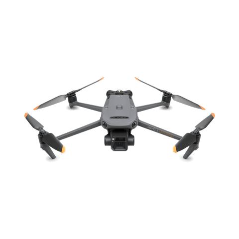
DJI Mavic 3E
... Open
Weight: 915 g.
Max Flight Time (no wind): 45 mins.
Sensing type: Omnidirectional binocular vision system, supplemented with an infrared sensor at the bottom of the aircraft.
Environment Adaptability: Max Take-off Altitude Above Sea Level 6,000 m; Max Wind Speed Resistance 12 m/s.
Wide Camera: 4/3 CMOS, Effective pixels: 20 MP.
Mechanical Shutter: 8-1/2000 s, supports rapid 0.7-second interval shooting.
Compatible with RTK module and DJI Cellular module.

Workflow
- Data Collection: Design a 2D map mission for consistent orthomosaic data acquisition.
- Data Processing: Utilize DJI Terra for processing, generating a high-accuracy dense Point Cloud from the collected data.
- Data Analysis: Measure stockpile volumes efficiently with DJI Terra. Alternatively, import the Point Cloud data directly into third-party software for comprehensive cut and fill analysis.
Automated Routine Stockpile Measurement Solution
The DJI Dock 2 allows you to automate recurrent stockpile measurement task effortlessly. Schedule remote data collection flights and upload collected data to DJI FlightHub 2 or your preferred Earthwork Software for timely project progress checks.
Schedule routine data collection flights for frequent centimetric level earthwork measurement and analysis.
Obtain accurate data outputs such as 3D Models, DSM, and Point Clouds for efficient earthwork monitoring.
Upload and analyze the collected data to DJI FlightHub 2 for cross-team collaboration.
Drone Platform
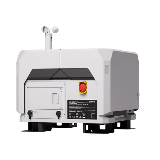
DJI Dock 2
... Open
Weight: 34 kg (without the drone).
Size: length 570 mm, width 583 mm, height 465 mm.
Environment adaptability: -25℃-45℃ working temperature, IP55 Rate, max operation height 4,000 m.
Max Operating Radius: 10 km.
Size: length 570 mm, width 583 mm, height 465 mm.
Environment adaptability: -25℃-45℃ working temperature, IP55 Rate, max operation height 4,000 m.
Max Operating Radius: 10 km.
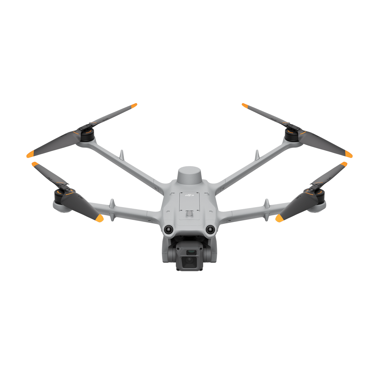
Matrice 3D
... Open
Weigh: 1410 g.
Size: length 335 mm, width 398 mm, height 153 mm(without propellers).
Max flight time: 50 minutes.
Max Operating Radius: 10 km.
Wide camera: 4/3 CMOS, 20MP, Mechanical Shutter: 8-1/2000 s.
Tele camera: 1/2" CMOS, 12MP.
Environment adaptability: -25℃-45℃ working temperature, IP55 Rate, max operation height 4,000m.
Payload And Software

Workflow
- Data Collection: Design a routine 2D map mission for consistent orthomosaic data acquisition.
- Data Processing: Process the data in DJI FlightHub 2 to generate a high-accuracy dense Point Cloud.
- Data Analysis: Utilize DJI FlightHub 2 or third-party software to compare the Point Cloud data with the design file, automatically calculating cut and fill measurements.