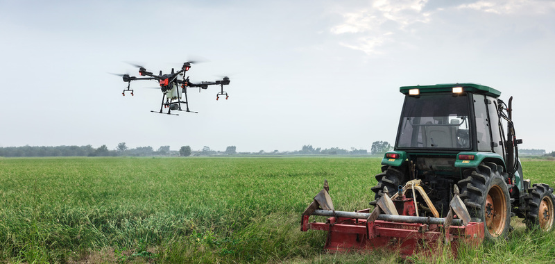
When it comes to optimized power for essential agricultural operations, there’s no better option than the Agras T16. Thanks to a robust modular design, 16 L spray tank, and incredible 3D planning, the T16 has significantly strengthened operational efficiency.
Today, farmers are open to utilizing new forms of technology to maximize their productivity when spraying or seeding. DJI’s agricultural solutions, like the T16, provide them the tools needed to do just that. As challenging as it is to thrive in the world of farming, agricultural drones have expedited the farmer’s pursuit of meeting industry demands.
Here are several reasons why the T16 is the perfect solution for your farm, from eliminating crop pests and disease, to reducing your environmental impact, to ensuring safety and precision in field operations.
Operation Efficiency Enhanced

Working with hazardous chemicals, like pesticides, herbicides, and fungicides, pose many health risks to people and livestock. However, a drone that can lift 16 L of liquid, is equipped with four delivery pumps and eight sprinklers, and can spray 4.8 L/min, is undoubtedly a step up from manual operations.
Farmers can now cover about 24.7 acres per hour without frequently coming into contact with hazardous chemicals. This not only increases productivity and ensures safer practices but also reduces the amount of labor needed during seeding or spraying operations. To make it plain, the T16 helps save time and money while keeping people and livestock out of harm’s way.
Innovative Features Simplify Drone Integration
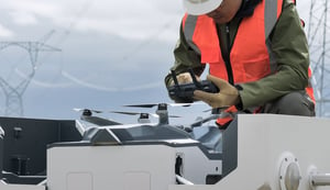
Operating powerful aerial equipment is not an easy task. Unless one is a professional pilot and has mastered all aspects of aerial spraying, a lot can go wrong rather quickly. Fortunately, features like Digital Beam Forming (DBF) imaging radar, an AI engine, and a wide-angle FPV camera ease the challenges that beginner pilots face. The DBF Imaging Radar allows the T16 to sense its surrounding environment, night and day. While flying, pilots can rely on the drone’s obstacle avoidance and its horizontal FOV to prevent accidental spraying or collision. The wide-angle FPV camera provides pilots with insightful live views, and a spotlight ensures safety even during nighttime operations. Safety is of vital importance, and with the T16, farmers can rest assured knowing they can avoid potentially dangerous situations whenever they choose to operate.

3D Planning Digitizes Farming
Perhaps the most impressive justification for using the T16 is the comprehensive digital solutions that have guaranteed efficient workflows. The Phantom 4 RTK helps collect valuable data, like images of various terrain, in under 25 minutes. DJI Terra processes your data and helps operators output 2D maps and 3D models for creating flight routes and obtaining detailed maps. The T16 can act upon these flight plans and protect your crops. This is an innovative way of optimizing workflow and increasing operational efficiency. With DJI Agriculture Management Platforms, data can be assessed and used to solidify flight plans further. These solutions, together with the T16, provide farmers with a fantastic solution for managing livestock, navigating challenging terrain, and performing accurate crop assessment.

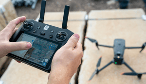
Incredible Single-Pilot Operation
A single T16 remote controller can control up to five T16 aircraft. This eliminates the need for several pilots flying simultaneously, significantly reducing costs. Different terrain raises different issues for farmers. Thankfully, the T16, along with various agricultural solutions, are ready to meet these challenges. The combination of the T16 and DJI Terra introduces a new Orchard mode. Farmers can use 3D operational planning to help identify and assess orchards before spraying begins. Innovative slope angle detection technology makes navigating uphill or across mountainous terrain simpler. Moreover, most spraying or seeding needs can be accomplished easily with one of the many smart modes dedicated to flat-ground operations.
Legally Operating Your T16
Although these features are exciting to learn about, and even more exciting to try out, T16 users must understand the legality behind operating a spraying drone. Users should follow all local rules and regulations that detail how to become a pilot, rules for operation, and how to obtain an official license. Users should also read the T16 Safety and Disclaimer Guidelines for essential information on drone operations. Pesticides pose serious health risks, as mentioned above, and should be used in accordance with their specifications. Other important rules include avoiding use in densely populated areas, wearing protective clothing, and maintaining full control over the aircraft at all times.
For more information about the T16 Safety and Disclaimer Guidelines, click here.
For more information about No-Fly Zones in your country or region, visit https://www.dji.com/flysafe/geo-map. Please note that the information provided here should not replace existing or new local laws and regulations.
If you’d like to learn more ways a drone could help your farm, click here.