DJI Introduces the New SDK Remote Controller for Phantom 4 RTK Pilots
SDK remote controller offers pilots access to the world's leading drone app ecosystem for survey missions
The use of commercial drones has increasingly become common practice for the survey industry. This comes as no surprise since drone mapping has proven to yield significant benefits when compared to traditional methods, with companies such as The Beck Group seeing a 25% reduction of rework across projects after using this technology.
As surveyors and large construction contractors have turned to DJI platforms as a new tool for collecting survey data, the open nature of software on DJI drone platforms has spawned a new generation of software providers producing compatible photogrammetry and automated mapping software.
To further enhance these developments, DJI is pleased to announce the Phantom 4 RTK SDK Remote Controller, which is Mobile SDK compatible – meaning, pilots with experience using 3rd party applications on DJI drones can now access the world's leading drone app ecosystem for their Phantom 4 RTK with the SDK remote controller.
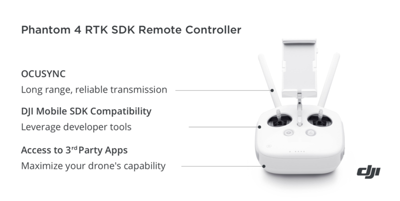
To harness the full power of the Phantom 4 RTK, users can connect a compatible Android or iOS device to the RC and install any compatible DJI Mobile SDK-enabled app. While developers have the ability to create their own custom apps through DJI Mobile SDK, operators can leverage these developer tools to optimize aircraft capability for surveying missions and other data acquisition scenarios.
In addition to providing access to the world’s largest app ecosystem, the SDK remote controller comes fully equipped with all the signature technologies that DJI users have come to know and expect, like DJI OcuSync, a transmission system that provides users with reliable HD image and video transmission at distances of up to 7 km.
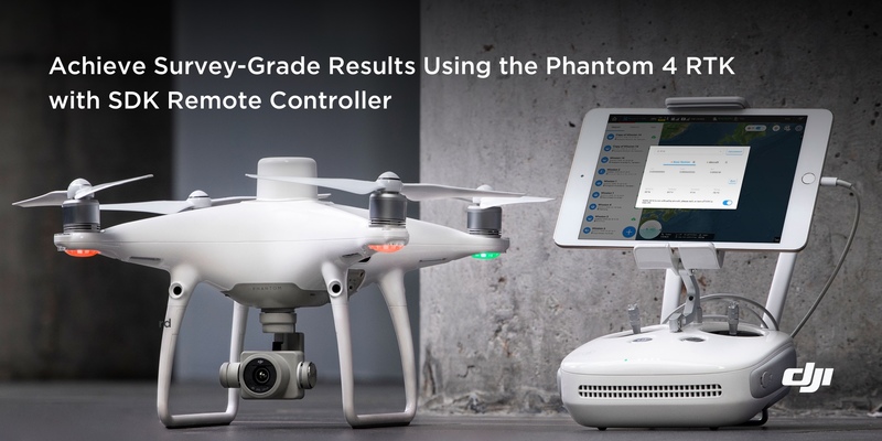
As a leader in the commercial drone space, DJI is committed to helping businesses and organizations tackle today’s workplace challenges with reliable and powerful drone solutions. Surveyors and enterprises that are seeking new and efficient tools to help optimize their workflows, can look toward the DJI Phantom 4 RTK, offering real-time, centimeter-level positioning data to produce survey-grade results.
The Phantom 4 RTK SDK Remote Controller is available worldwide through DJI’s authorized enterprise resellers. Users who already own a Phantom 4 RTK can purchase the SDK remote controller separately. For more information about the Phantom 4 RTK and relevant accessories, please visit https://www.dji.com/phantom-4-rtk.
Where to learn more:
• Contact DJI today to explore the benefits of drones for mapping
• Subscribe to DJI Enterprise’s newsletter to stay tuned with the latest commercial drone news!
• Discover more potentials of LiDAR and drones at DJI’s annual commercial drone conference AirWorks 2019
Other News
 The Basics of Positioning Accuracy in Aerial Surveying2020-03-12
 Innovating to Fight COVID-19: Four Ways Drones are Contributing2020-03-11