Wildlife Protection
Wildlife monitoring and preservation are crucial yet challenging endeavors. Drones enhance the efficiency of monitoring efforts by quickly covering vast areas and pinpointing subjects of interest with high-resolution zoom and thermal imaging cameras.
Painpoints
Advantages
Teams often have to traverse extensive areas on foot, which limits daily coverage.
Rapidly survey expansive areas with aerial monitoring technology.
Navigating difficult terrains to track wildlife activities poses risks to personnel.
Ensure the safety of personnel in rugged terrains by using drones to scan for wildlife, eliminating the need for ground patrols.
Conventional monitoring methods depend on manual record-keeping, leading to inefficient knowledge transfer.
Maintain digital records of individual animals or environmental changes, facilitating easy storage and sharing of drone-collected data.
Animals may react to human presence by concealing themselves, complicating the process of locating and observing them.
Employ thermal imaging and zoom capabilities to observe wildlife without disturbing their natural behaviors.
Solution
Portable Thermal Wildlife Monitoring and Anti-Poaching
Weatherproof High-Performance Monitoring and Anti-Poaching
Portable High-Performance Monitoring and Anti-Poaching
Portable Thermal Wildlife Monitoring and Anti-Poaching
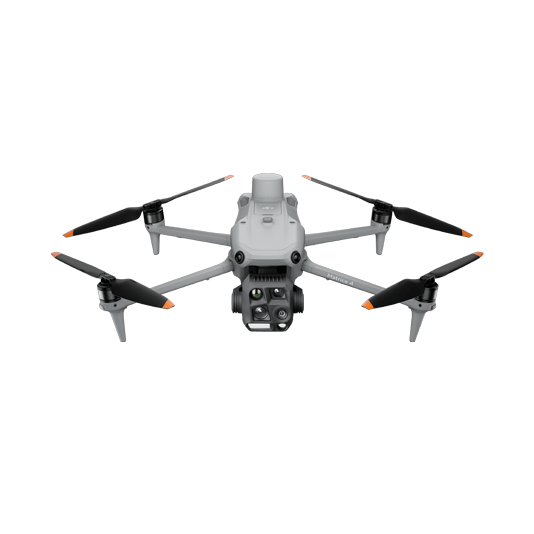
The DJI Matrice 4T enables wildlife conservation teams to identify and document wildlife using high-quality thermal and visual imagery. This solution is user-friendly, allowing for easy deployment and operation by a single pilot. Thanks to its portability, it is convenient to carry on extended research expeditions.
A portable solution that is simple to operate and transport.
Equipped with a high-quality thermal sensor to identify and document wildlife behavior.
Features high-resolution zoom capabilities, allowing for the monitoring of animals from a safe distance.
Drone Platform

DJI Matrice 4T
... Open
Weight: 1219 g (with propellers)
Max Flight Time (without wind): 49 minutes
Environment Adaptability: Max takeoff altitude 6000 m, max wind speed resistance 12 m/s
Sensing System: Omnidirectional binocular vision system, supplemented with a 3D infrared sensor at the bottom of the aircraft
Wide-Angle Camera: 1/1.3-inch CMOS, 48MP effective pixels (Matrice 4T)
Medium Tele Camera: 1/1.3-inch CMOS, 48MP effective pixels
Telephoto Camera: 1/1.5-inch CMOS, 48MP effective pixels
Infrared Thermal Camera: 1280 × 1024@30fps (Super Resolution enabled, Night Mode not activated)
Laser Rangefinding: 1800m measurement range (1 Hz) @20% reflectivity target
Payload And Software

DJI Pilot 2
... Open
Ground control
Workflow
- Data Collection:
- Using the DJI Pilot 2 app, fly over the area of interest using the visual and thermal sensors looking for wildlife activity and capturing photos and videos. - Data Analysis:
- Import the collected information into a database or storage to serve as reference and knowledge base for research teams.
Weatherproof High-Performance Monitoring and Anti-Poaching
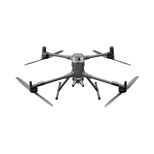
The Matrice 400 is a robust multi-sensor payload designed to perform in harsh environments. Equipped with the Zenmuse H30 series, it offers advanced thermal imaging, a laser rangefinder to accurately locate individuals or poachers, and night vision capabilities for effective nocturnal wildlife monitoring.
IP55 Ingress Protection provides a weatherproof solution ideal for harsh environments.
1280 × 1024 high-resolution thermal sensor for enhanced clarity.
Black and white or full-color night vision imaging capabilities.
Laser rangefinder to accurately document the coordinates of individuals.
Dual-Control feature to enhance reliability and ensure operational safety.
Drone Platform

DJI Matrice 400
... Open
Weight: 9740±40 g (with batteries)
Max Takeoff Weight: 15.8 kg
Max Payload: 6 kg
Max Flight Time: 59 minutes
Max Horizontal Speed: 25 m/s
Sensing System: Omnidirectional binocular vision system (surround view provided by full-color fisheye vision sensors), horizontal rotating LiDAR, upper LiDAR, downward 3D infrared range sensor, and six-direction mmWave radar
Environment Adaptability: IP55 rating, max takeoff altitude 7000 m, operating temperature -20° to 50° C (-4° to 122° F)
Compatible with the Zenmuse H30 Series, Zenmuse L2, Zenmuse P1, Zenmuse V1, Zenmuse S1, and third-party payloads.
Payload And Software

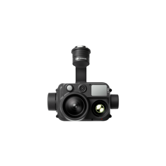
Zenmuse H30T
... Open
Wide-Angle RGB Camera: 1/1.3-inch CMOS, 48MP effective pixels
Zoom RGB Camera: 1/1.8-inch CMOS, 40MP effective pixels, 34× hybrid optical zoom
Infrared Thermal Camera: 1280×1024@30fps
NIR Auxiliary Light Illumination Range: Approx. 8m diameter circle@100 m
Laser Range Finder: Max measurement range 3000 m
Zoom RGB Camera: 1/1.8-inch CMOS, 40MP effective pixels, 34× hybrid optical zoom
Infrared Thermal Camera: 1280×1024@30fps
NIR Auxiliary Light Illumination Range: Approx. 8m diameter circle@100 m
Laser Range Finder: Max measurement range 3000 m

DJI Pilot 2
... Open
Ground control
Workflow
- Data Collection:
- Using the DJI Pilot 2 app, fly over the area of interest using the visual and thermal sensors looking for wildlife activity and capturing photos and videos.
- Use features like PinPoint, Black and White Night Vision or Side-by-Side Thermal and Visual Screens for a more comprehensive evaluation of the wildlife behavior. - Data Analysis:
- Import the collected information into a database or storage to serve as reference and knowledge base for research teams.
Portable High-Performance Monitoring and Anti-Poaching
The Matrice 30 series offers the perfect balance between portability and performance. It's robust design and ingress protection makes it a suitable solution for wildlife monitoring in harsh environments. It offers high-resolution thermal imaging and laser rangefinder to accurately locate individuals or poachers.
IP55 Ingress Protection offers a weatherproof solution that is perfect for harsh environmental conditions.
Laser rangefinder accurately records the coordinates of individuals.
Hot-swappable batteries enable uninterrupted operation.
Dual-Control feature improves reliability and guarantees operational safety.
Drone Platform

Matrice 30T
... Open
Weight (incl. two batteries): 3770 ± 10 g.
Max Flight Time: 41 min.
Sensing system: Six-directional sensing and positioning.
Environment Adaptability: Max Service Ceiling Above Sea Level (without other payload) 7,000 m (with 1676 propellers); Max Wind Resistance 12 m/s.
Zoom camera: 1/2-inch CMOS, Effective pixels: 48MP.
Max Flight Time: 41 min.
Sensing system: Six-directional sensing and positioning.
Environment Adaptability: Max Service Ceiling Above Sea Level (without other payload) 7,000 m (with 1676 propellers); Max Wind Resistance 12 m/s.
Zoom camera: 1/2-inch CMOS, Effective pixels: 48MP.
Payload And Software

DJI Pilot 2
... Open
Ground control
Workflow
- Data Collection:
- Using the DJI Pilot 2 app, fly over the area of interest using the visual and thermal sensors looking for wildlife activity and capturing photos and videos.
- Use features like PinPoint or Side-by-Side Thermal and Visual Screens for a more comprehensive evaluation of the wildlife behavior. - Data Analysis:
- Import the collected information into a database or storage to serve as reference and knowledge base for research teams.